


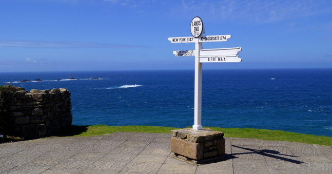
How far is it from Land’s End to John O’Groats?
Traveling from Land’s End to John O’Groats will mean you are traveling the whole length of mainland Great Britain from its most southerly point, to its most northerly! But how far is it from Land’s End to John O’Groats?
The distance between Land’s End to John O’Groats all depends on what route you take! The distance is 603 miles (970km) as a straight line between the two locations (as the crow flies). However, if you are looking to complete the journey by car then the shortest distance is 837 miles (1347km) along motorways and minor roads.
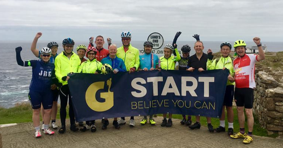
But we think the best way to travel between Land’s End and John O’Groats is definitely by bike! The shortest cycling distance between the two points is 874 miles (1,407km) – however this involves many busy roads and isn’t necessarily the safest. Therefore, on our LEJOG challenge. we take an epic 1000 mile (1609 km) journey - in order to stay safe and explore some of the best scenery in the UK!
LAND'S END TO JOHN O'GROATS ROUTE
Day 1: Land’s End to Liskeard
Total Distance: 78 miles / Total Ascent: 7376 ft / Total Descent: 7,160 ft
Today we set off from Land’s End and cycle through quiet hamlets to the stunning Mousehole Harbour. We continue along National Cycle Route 3 to Liskeard.
Day 2: Liskeard to Tiverton
Total Distance: 59 miles / Total Ascent: 7,555 ft / Total Descent: 7,843 ft
We cycle along smooth roads with stunning views overlooking Dartmoor, before taking on the Dartmoor hills!
Day 3: Tiverton to Tintern
Total Distance: 92 miles / Total Ascent: 5,046 ft / Total Descent: 5,150 ft
Today we follow the course of the River Exe and cycle down single track roads between agricultural and cider farmland. We then cycle along Flax Bourton road with views towards the Severn Estuary.
Day 4: Tintern to Shrewsbury
Total Distance: 85 miles / Total Ascent: 5443 ft / Total Descent: 5307 ft
We leave the historic town of Tintern and follow the River Wye. We climb steadily up to Church Stretton and cycle through the historic town of Shrewsbury.
Day 5: Shrewsbury to Preston
Total Distance: 95 miles / Total Ascent: 3625 ft / Total Descent: 3712 ft
Today we leave Shrewsbury, following the River Severn. We cycle along local cycle paths and National Cycle Routes to Preston.
Day 6: Preston to Carlisle
Total Distance: 95 miles / Total Ascent: 5031 ft / Total Descent: 5074 ft
We head north to the coast and reach Shap, with stunning views of the Lake District. We then take on one of the toughest climbs of the challenge and cycle past “King Arthur’s Round Table”.
Day 7: Carlisle to Kilmarnock
Total Distance: 109 miles / Total Ascent: 6480 ft / Total Descent: 6146 ft
Today we cross the border in Scotland and cycle straight into the heart of the Forest of Ae. We cycle past Loch Ettrick and take on a steep climb just after Tynron.
Day 8: Kilmarnock to Inveraray
Total Distance: 78 miles / Total Ascent: 5593 ft / Total Descent: 5952 ft
We head towards Erskine Bridge via the cycle network, and continue cycling north to the famous Loch Lomond.
Day 9: Inveraray to Fort William
Total Distance: 71 miles / Total Ascent: 6623 ft / Total Descent: 6563 ft
We leave Inveraray and follow the River Aray north to Loch Awe and then on to Fort William – our overnight stay, where we have fantastic views of Ben Nevis.
Day 10: Fort William to Tain
Total Distance: 103 miles / Total Ascent: 7261 ft / Total Descent: 7241 ft
Today we cycle around Loch Lochy, stopping off at the lovely Fort Augustus. In the afternoon we cycle along Loch Ness, before reaching Tain.
Day 11: Tain to Bettyhill
Total Distance: 69 miles / Total Ascent: 3788 ft / Total Descent: 3678 ft
We enjoy a cycle around Dornoch Firth before journeying along small country roads to the falls of Shin. We then cycle along Altnaharra, with great views of the surrounding rivers and streams.
Day 12: Bettyhill to John O’Groats
Total Distance: 59 miles / Total Ascent: 3984 ft / Total Descent: 4184 ft
Our last day of our cycle challenge! We follow the coastline and cycle through the rolling hills of Scotland. We visit Dunnet Head Lighthouse before arriving at our destination – John O’Groats.
This is our most challenging UK cycle and a tough journey through England, Scotland and Wales - testing you both mentally and physically. However, the fantastic, diverse scenery you will witness on this long distance cycle and the incredible sense of achievement you will feel upon reaching John O’Groats will make all the miles and steep inclines worth it!
Take on the length of Britain by bike and join us as we conquer Lands End to John O’Groats!
Related Blogs;
- Incredible Challenges You Can Do for Charity
- Discover Your Next Adventure
- What Kit Do You Need to Cycle Across Europe
Share this with your friends


